Hillsboro RV Parks & Campgrounds
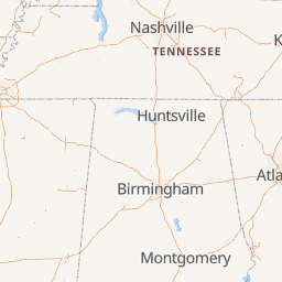
Campgrounds near Hillsboro, Alabama
Commercial & Private
State Parks, Forests, and Preserves
National Parks, Forests, and Preserves
Canadian National Parks
Canadian Provincial and Preserves
Corps of Engineers
BLM & DNR
US Forest Service
County Park
City Park
TVA Park
Military Only
Pull-thru Sites
Pets Allowed
Big Rig Access
Tent Camping
55+ Only
Kid Friendly
Boondocking
Cabins & On-site Rentals
Dump Station
Group Camping
Dispersed Camping
Workamping
Class A Only
No Minors
Full Hookup
Electric 50 AMP
Electric 30/20/15 Amp
Sewer
Cable/Sat. TV Hookup
Central Water Spigot
Public Phone
Water
Restrooms
Showers
Laundry
Camp Store
Pet Area
Propane Available
Cafe / Snack Bar
Clubhouse
Firewood Available
Group Kitchen
Horse Camp
Landing Strip
Picnic Shelter
Restrooms: vault
Church Affiliated
Clothing Optional
Winery
RV Dealership
Fairground
Specialty Park
Permanent only
Members Only
Pool
Playground
Recreation Trails
Rec Room
Casino
Fishing
Beach
Biking
Boating
Golf
Gym/Workout Facilities
Horseshoes
Mini-Golf
Outdoor Courts
Pickleball
Water Access
WiFi
Nightly Price
$0 - $125
Elevation
-300' - 20,000'
Number of Sites
0 - 500
Map Updating
Featured Campgrounds
Highly Rated RV Parks Near Hillsboro, Alabama
Recent Reviews of Campgrounds near Hillsboro, Alabama
Tips from campers about Hillsboro, AL
- DarrinNBama Dollar General is close by if u forgot or need anything8 months ago Decatur/Wheeler Lake KOA Holiday
- adk_man There is a beach, and rentals available for pontoon boats, kayaks, and jet skis.8 months ago Decatur/Wheeler Lake KOA Holiday
- Noles Not anything close to do for kids or adults. 20 minute drive to Decatur for food at Publix or WMSC, movies, Lowes and Home Depot. 1 & 1/2 hours to Huntsville for some history sites and fun.9 months ago Decatur/Wheeler Lake KOA Holiday


